Pilgrimage to Site Alpha
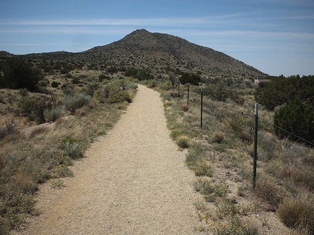
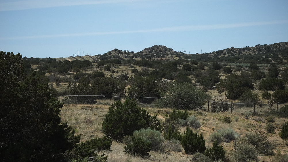
Post-Script: Hiking around the city-managed open space just east of Four Hills and adjacent to the KAFB fence line, the inner perimeter fence around Site Alpha is clearly visible, as are periodic patrols by unmarked white trucks.
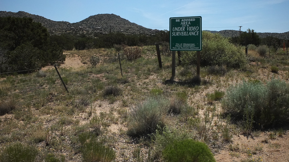
Also worth noting is clear signage in the open space warning that the area is under video surveillance, something I haven't seen in other open public hiking areas along the Sandia foothills.
Also worth noting is that I located a survey marker near the KAFB fence, indicating the civilian area outside the base is BLM ( Bureau of Land Management), meaning it's federally-protected public open space.
Several decades ago there was a story about a rancher who managed to wander into the base from the Manzano Mountains, in search of stray cattle.
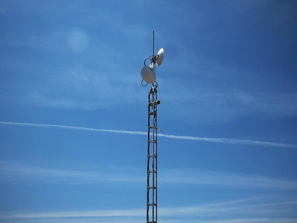
Photos via Fujifilm X10, typecast via Smith-Corona Galaxy 12.
UPDATE 6.24.2015: Some might wonder what's the point of this article, is it excessive curiosity, or some darker, anti-establishment streak?
I see it mainly as history: our nation's history, for the latter half of the 20th century, was dominated by the threat of nuclear weapons; there's the local angle, that of New Mexico being placed squarely in the midst of the nuclear weapons history (and thus presumably having been targeted by our foes), and who's local environment and economy has been affected, both positively and negatively; and personal history, as my dad worked in this field for most of his career.
Obviously, these devices and their knowledge are not disappearing; Pandora's box has been opened, and physics is not easily untaught; nor does this country have a monopoly on the laws of nature, as if we could rescind them at any time. And so pretending like they do not exist, or that the industries and infrastructure in place to support them are invisible, is childishly unrealistic. In the 1950s, as the US was building up a vast arsenal of multi-megaton weapons (and presumably storing many of them here at Site Alpha), the modern suburb of Four Hills was also being built up, under its shadow, just across a wire fence. Somehow, these people were able to sit out on their patios in the cool evening breeze and completely ignore the obvious. So, too, did most of the nation at that time. History has not fully accounted for the mass denial responsible for this phenomenon.
Others too have taken notice of the national security infrastructure, most notably Trevor Paglen, whose intense documentations of various aspects of the these infrastructure made visible are worth the study.
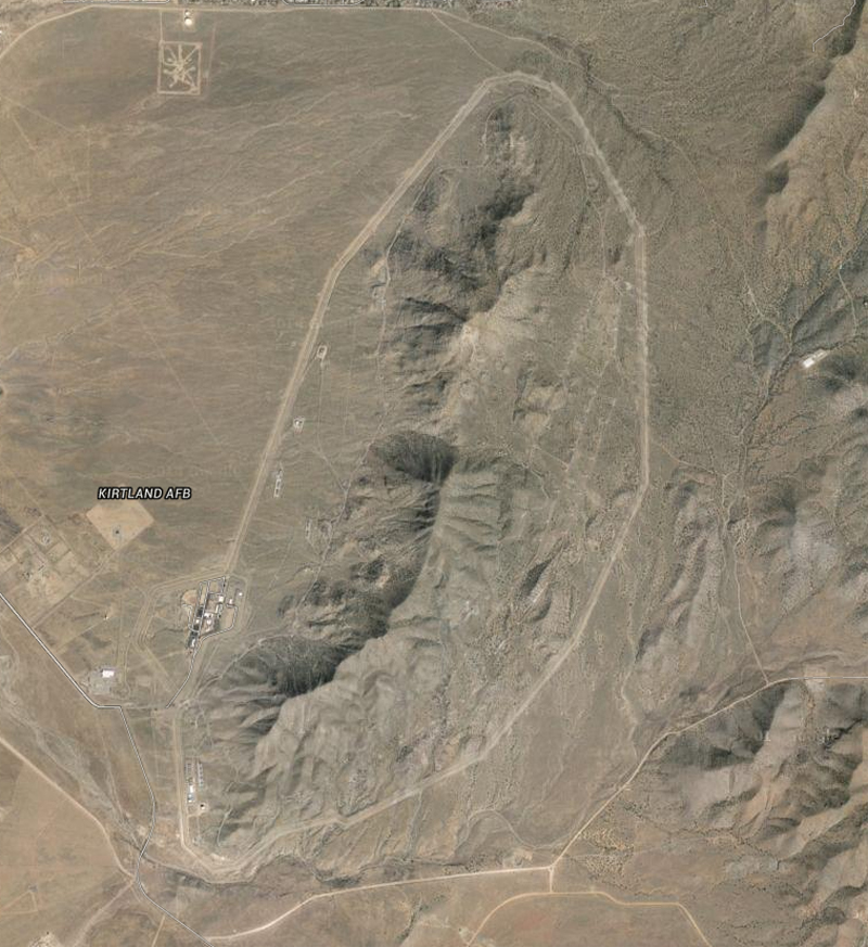
Good fences perhaps do make for good neighbors, but let's not forget that these same institutions also brought us the technology of Google Maps. Here's Site Alpha from satellite. North is up, you can barely seen the fence line in the top of the image where Four Hills begins.
Update #2, 6.24.2015: Correction to the broken arrow reference, the bomber crashed into the mountain in 1950, thus it would have been carrying an atomic bomb. As per Wikipedia:
April 11, 1950 – Albuquerque, New Mexico, USA – Loss and recovery of nuclear materials
Three minutes after departure from Kirtland Air Force Base in Albuquerque a USAF B-29 bomber carrying a nuclear weapon, four spare detonators, and a crew of thirteen crashed into a mountain near Manzano Base. The crash resulted in a fire which the New York Times reported as being visible from 15 miles (24 km). The bomb's casing was completely demolished and its high explosives ignited upon contact with the plane's burning fuel. However, according to the Department of Defense, the four spare detonators and all nuclear components were recovered. A nuclear detonation was not possible because, while on board, the weapon's core was not in the weapon for safety reasons. All thirteen crew members died.
There was a later broken arrow on KAFB in 1957 involving a dropped H-bomb; again from Wikipedia:
May 22, 1957 – Kirtland AFB in New Mexico, USA – Non-nuclear detonation of an atomic weapon
A B-36 ferrying a nuclear weapon from Biggs AFB to Kirtland AFB dropped a nuclear weapon on approach to Kirtland AFB. The weapon struck the ground 4.5 miles south of the Kirtland control tower and 0.3 miles west of the Sandia Base reservation. The weapon was completely destroyed by the detonation of its high explosive material, creating a crater 12 feet deep and 25 feet in diameter. Radioactive contamination at the crater lip amounted to 0.5 milliroentgen.
posted by Joe V at 6:28 PM
![]()
![]()

0 Comments:
Post a Comment
<< Home